Tourmalet

Tourmalet
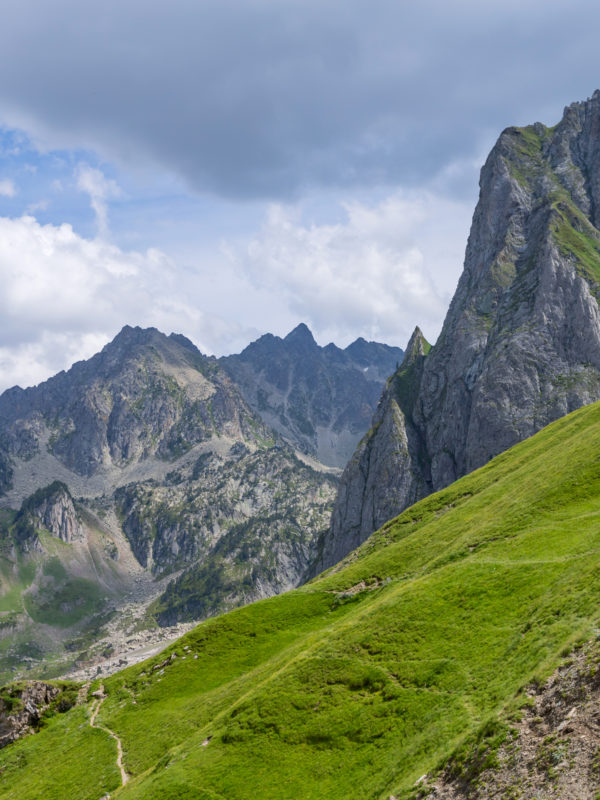
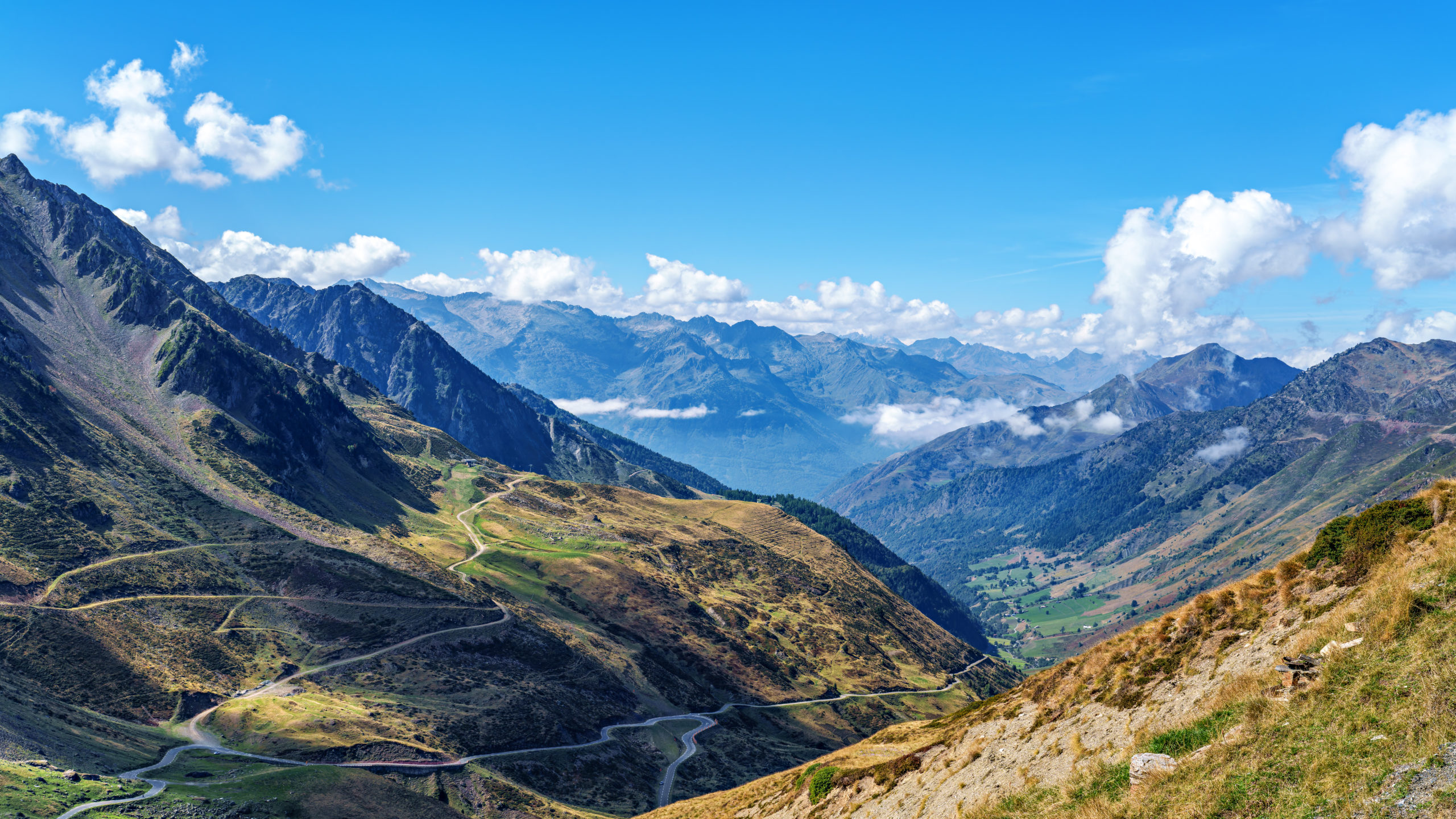
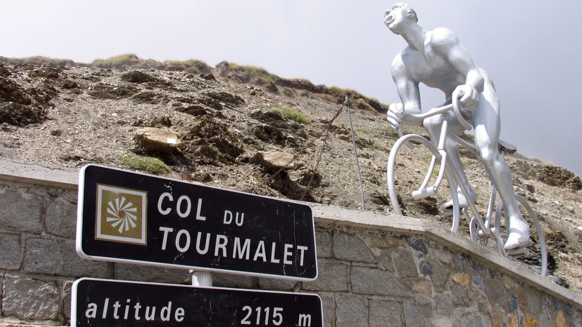
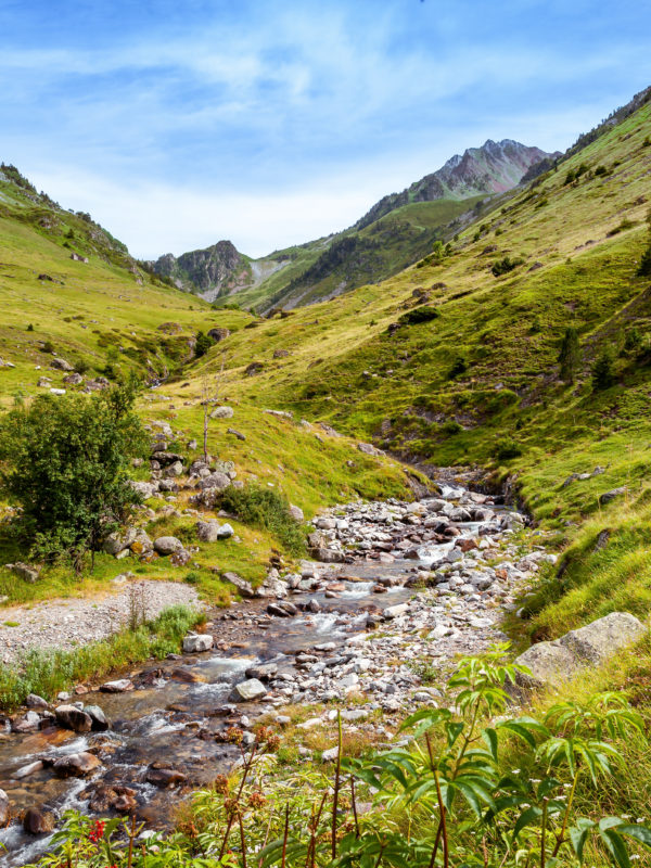
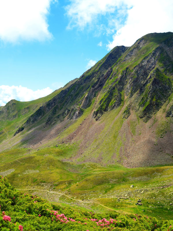
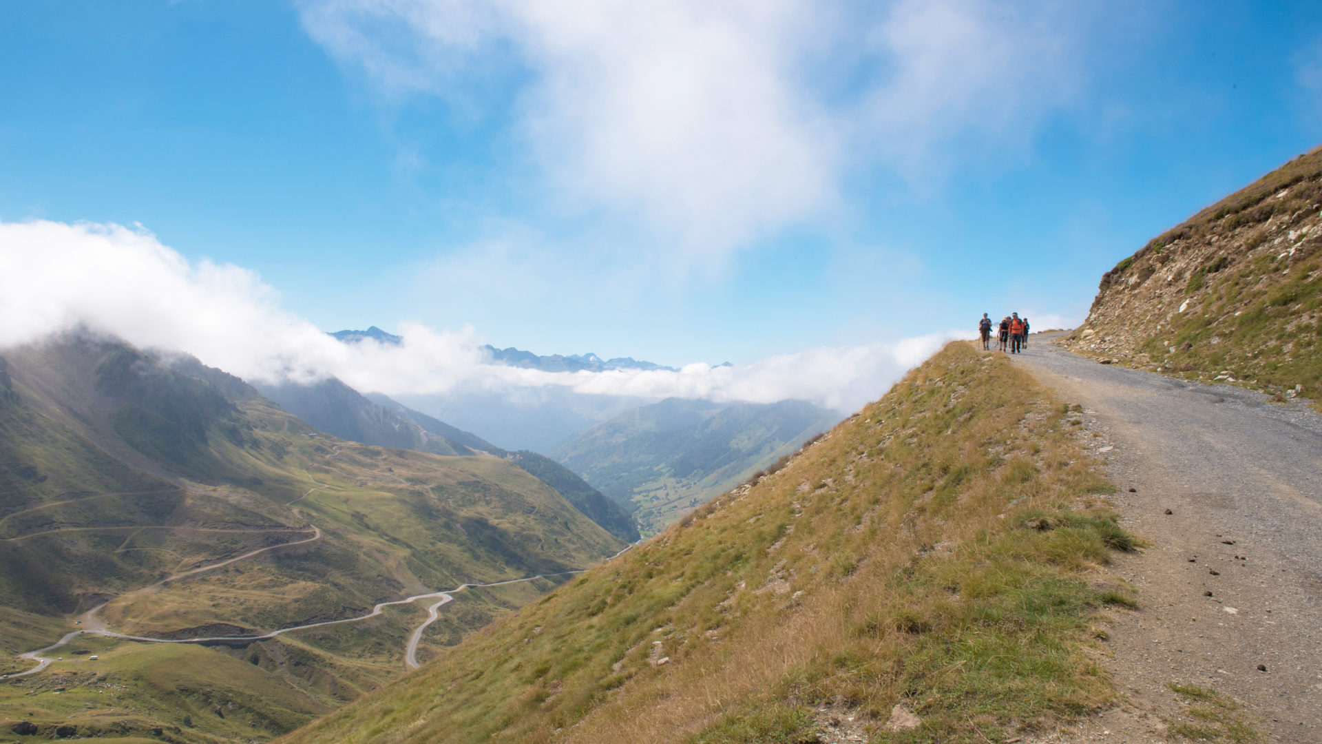
Tourmalet is a famous Pyrenean pass in the Occitanie region. It is located some 50 km south of Tarbes. The Col du Tourmalet is famous for its 2115-meter altitude, and is specially dedicated to the practice of uphill tourism. On arrival in the area, tourists and sports enthusiasts can appreciate the presence of a statue depicting a cyclist preparing to climb a mountain. Tourmalet is dominated by the Pic du Midi de Bigorre to the north and the Pic d’Espade to the south. Although the area is popular for a number of sports, it’s also a great place to enjoy breathtaking views of the rest of the region just a few kilometers from your Tourmalet campsite.
A popular area for cycling
Tourmalet is first and foremost dedicated to cycling. The ascent begins at Luz-Saint-Sauveur at 710 m. This west-facing slope is slightly less steep, which means that enthusiasts can enjoy the ascent gradually. There are frequent straights on some sections, allowing you to catch your breath before continuing on. The slopes are different on each ascent. The descent is also possible, but care must be taken to avoid steep, dangerous slopes if you’re not an amateur. Once off the slopes, you can continue cycling in the style of a leisurely stroll. At the bottom of the peak, the greenery takes over and you can take the little paths that lead to the Tourmalet d’Arriou campsite. It’s a great place to take a break or just relax for a quiet, unique stay.
Tourmalet: a mythical place
Tourmalet ‘s fame has always revolved around cycling. The first known race in the area dates back to August 18, 1902. In those days, the race was known as the “Concours de Bicyclette de Tourisme”, organized by the Touring Club de France. The start and finish were located in Tarbes. It was Jean Fischer who went first and almost finished the race as winner, but due to a puncture, he finished second and was beaten by Rodolfo Muller.
It was this first race that unleashed the popularity of the following ones, namely that of the legend of the Tour. After that, the Tour de France was back on track, with professionals and amateurs alike vying for the top prize at every turn. Among the most famous names were Bayonne-Luchon and Eugène Christophe. The list is by no means exhaustive, and there are plenty of names to choose from. In the Occitanie region of France, Tourmalet is not only a paradise for cyclists, but also for those who enjoy the sport and the views.
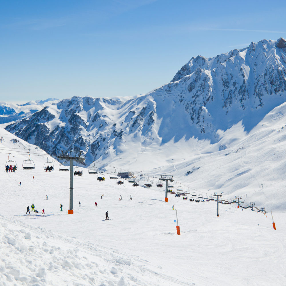
Towards skiing and hiking
With its mountain pass, Tourmalet is the largest ski area in the area. As such, it remains a popular destination for winter skiers. In addition to skiing, other winter sports can also be enjoyed here. Some tourists also prefer a good hike from some of the well-known points close to the Hautes Pyrenees campsite.
From the Pic du Midi, the hikes quickly take on the feel of a good excursion, leading to unsuspected heights. The descent takes place slowly through Bigorre or Sainte Marie Campan, returning to the campsite for those looking for a good place to stay in the area.
How long does it take to climb the Col du Tourmalet?
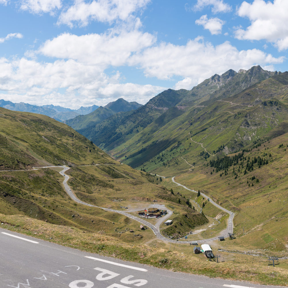
The Col du Tourmalet is a mythical route known as one of the stages of the Tour de France. It is a favorite with amateur and professional cyclists alike, as well as lovers of the great outdoors. With a distance of 19 km, the route has an average gradient of 7.4%, a maximum gradient of 10.2% and a highest point of 2,115 m.
We recommend starting the route on the west side, at Luz-Saint-Sauveur. This is a very gentle start, with a starting altitude of 711 m and regular gradients of almost 8%. That said, it’s also possible to start the climb in Argelès-Gazost, which is an important stopover for those coming from the Col de l’Aubisque or the Col de Soulor.
This brings us right back to the way of exploring the Col du Tourmalet and the surrounding villages. A professional cyclist can make the ascent in less than an hour, while an amateur will need around 2 hours to climb the Col du Tourmalet.
How do you cycle up the Col du Tourmalet?
If you’re planning to start in Argelès-Gazost, we recommend taking the voie verte from Lourdes up to Pierrefitte-Nestalas. This avoids two of the region’s busiest roads, the D 921 and D 913.
You’ll need to pedal for a good dozen kilometers to reach Luz-Saint-Sauveur, where the gradients approach 8%. Luz-Saint-Sauveur is also appreciated for the width of its road, which is lightly trafficked and offers an exceptionally beautiful panorama.
You’ll need stamina, however, as no less than six kilometers of constant ascent await you. Some sections pass between trees and include hairpin bends. On some parts of the route, you’ll be treated to 12% gradients.
Why is the Col du Tourmalet a legendary stage in the Tour de France?
The Col du Tourmalet is famous precisely for its difficulties. When you consider the rest of the climb that awaits the cyclists, what we’ve just described sounds more like an amuse-bouche.
After 6 kilometers of steady climbing, hairpin bends and gradients of up to 12%, we finally arrive at the village of Barèges, the perfect resort for a coffee break. The adventure continues on a fairly wide but little-travelled road, especially away from Barèges.
A few kilometers further on, some cyclists descend the Touët-et-Labach road, while others follow the D 918, the Tourmalet road. From here, despite the difficulties of the climb, you’re rewarded with magnificent views of the surrounding countryside. Thrill-seekers will appreciate the hairpin bends that sharpen the climbing sensation.
And we’re not done with the difficulties yet. It’s on the final kilometer that the gradients are at their steepest, averaging 10.5% and rising to 13%. It’s a tough climb, but the reward is a fine view of the Tourmalet Giant statue at the top of the pass. We also take the opportunity to refresh ourselves at the Restaurant du Tourmalet.